The late Alfred Wainwright once wrote that to him, a map was as good as a well-written novel: he could sit in his armchair, study a map and be instantly transported to another place, even if the map was of somewhere he had never visited.
I must admit that I agree with him on that – and I speak as one who loathed geography at school. The Blogger’s bookshelf is full of maps of different areas and periods, which are invaluable to my research.
The importance of maps in local history is obvious – it would be be almost impossible without them – but what use are they to the family historian?
To start with the obvious: maps help us identify places. They can help us find where our ancestors lived and worked. They can create a picture of the world in which our ancestors lived. Maps can even compare that long-ago world with the modern world. We can compare modern maps with old maps and with photographs. We can walk the streets which our ancestors walked on their way to work or school – we can trace their journeys and – if we’re lucky – see the same buildings which they would have seen.
A gazetter of the county you are studying is invaluable: I frequently refer to “An Historical Atlas of Staffordshire” by ADM Phillips and CD Phillips, as well as a modern A to Z.
Many other types of map are available – I’ll share a few ideas with you.
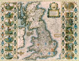
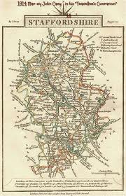
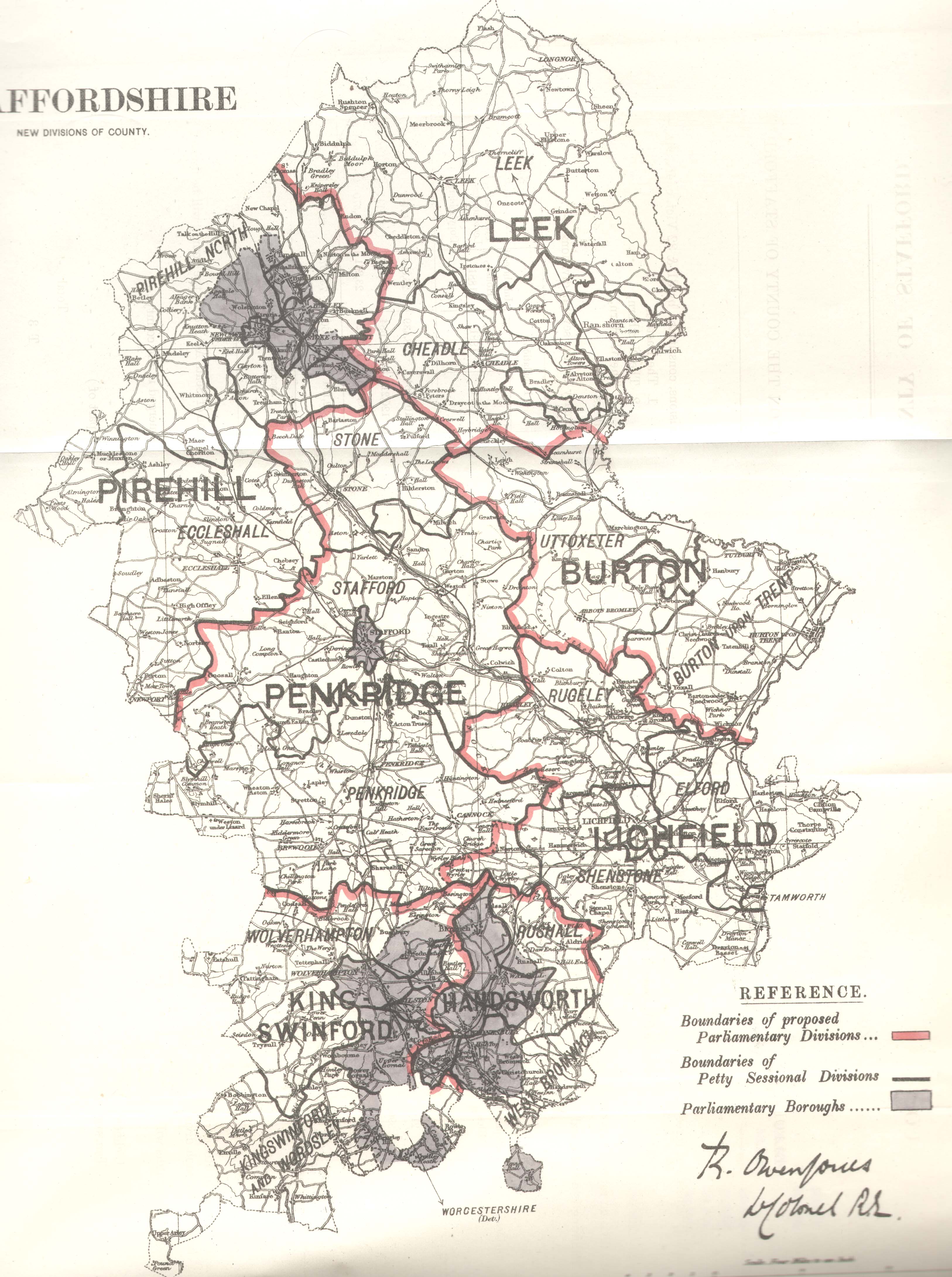
County Maps
 County Map of Staffordshire proir to the 1974 reforms
County boundaries change over the years – the most radical being the reforms of 1974, which abolished some counties altogether, and created some new ones, such as Cumbria, created from the traditional counties of Cumberland and Westmoreland, the County Borough of Carlisle, and parts of Lancashire and the West Riding of Yorkshire. Some of the traditional counties such as Rutland were dissolved but have now been re-established: and some of those created in 1974 have since been dissolved under later reforms (for example, Humberside).
But 1974 was not the only time in which boundaries changed. The village of Newport in Staffordshire was at one point in Shropshire: the town of Dudley was part of Worcestershire, but entirely surrounded by Staffordshire (and this “island” of Worcestershire known as “Worcestershire Detached”). County maps are therefore essential for identifying where a particular place lay.
The best single source of county maps that I have found is the Phillimore Atlas, which contains maps of every single county in England and Wales (showing every parish within each county), and far more besides. You can find a copy of Phillimore in Records Offices, local archives and larger reference libraries – you can also find second-hand copies quite easily.
Town Maps
 Wolverhampton Town boundaries 1885
Town maps are useful, not only for identifying where your ancestors may have lived/worked/married, but also because, just as county boundaries change over the years, so do town boundaries. As an example, in Victorian times the parishes which made up the town of Wolverhampton were far fewer than today: they did not include, for example, the parishes of Penn and Heath Town.
You can find maps showing town boundaries in local Records Offices and archives.
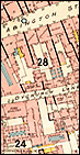
Ordnance Survey and other street maps
 Alan Godfrey Maps
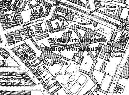
Larger-scale town maps can be used to pinpoint exact streets or properties which no longer exist. I have a collection of the reprints of Ordnance Survey maps published by Aan Godfrey Maps, and collect old town maps whenever I come across them.
Here is an extract from the OS map of 1901 showing the position of the old Wolverhampton Workhouse in Bilston Street, which gives an idea of the wealth of detail shown on these maps:
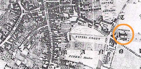
but the original workhouse in Horsley Fields is shown on Isaac’s Taylor’s Wolverhampton map of 1750:
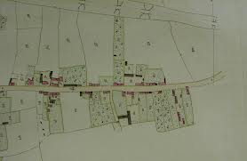
Tithe Maps and Inclosure Act Maps
These maps give details of land ownership, and are essential when researching the history of an area. All boundaries on these type of map are carefully plotted.
 Extract from tithe map of Hillmorton, Worcestershire
 Extract from Inclosure Act Map for part of Badsey, Worcestershire
Tithe and Inclosure Act maps can be found at County Records offices and archives.
Fire Insurance Maps
 Extract from Goad plan
Many fire insurance companies drew up detailed maps, which may show (depending on the age of the map) street name and number, the outline of each building, its size, shape and the material it is built from, function of the building , and location of windows and doors. The maps may also even indicate street and pavement widths.
The most common form of fire insurance map are known as”Goad” plans, and date from 1885 to the present day. They may be held in the Local Record Office or archive: the British Library also holds a collection of the first editions of the plans.
Conveyancing/Land Registry Plans
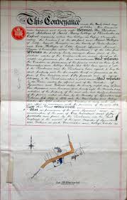 Conveyance with plan
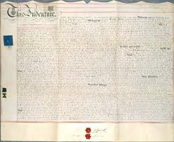 and, less helpfully, one without.
Conveyancing (or “the dark art” as it was known in the far-off days when I was a property lawyer) is dependent on descriptions of the land in question. However, historically not all conveyances included plans, and not all conveyances have survived. The best place to search will again be Local or County Records Offices and archives.
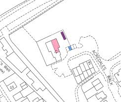 Land Registry plan
Since 1991, all property in England and Wales has been subject to compulsory registration at the Land Registry on change of ownership: this doesn’t mean that every property in the country is registered, however. You can obtain copies of Land Registry plans (and of the entry in the Land Register) from the Land Registry – but please be aware that sometimes these documents don’t contain very much detail of interest to the historian.
Other types of map

It’s always worth searching through the collections of the Local/County Records Offices and archives – other maps which may be of interest include sewerage scheme, road widening and other town improvement plans.
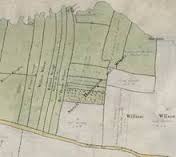
Where you’re researching an area which formed part of a landed estate, estate plans and documents may also have been deposited, often as part of sales particulars:
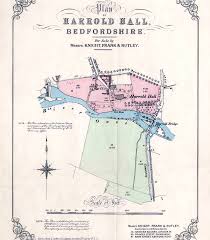 Estate plan of Harrold Hall, Bedfordshire
Online Resources
The internet is, as ever, your friend here: try searching not only for the name of the place together with the word ‘map’ in your normal search engine, but also try this as a specific search term in Google Images. The following websites may also turn up trumps for you:
www.old-maps.co.uk – free-to-use site where you can browse historic maps
www.maps.nls.uk/os/ – National Library of Scotland free-to-view site, not limited to Scottish Maps. Some of the maps in this collection can be overlaid on modern maps; and of particular interest may be the 1893-96 OS maps of London, plotted at a massive five feet to the mile.